A Century of Great Earthquakes
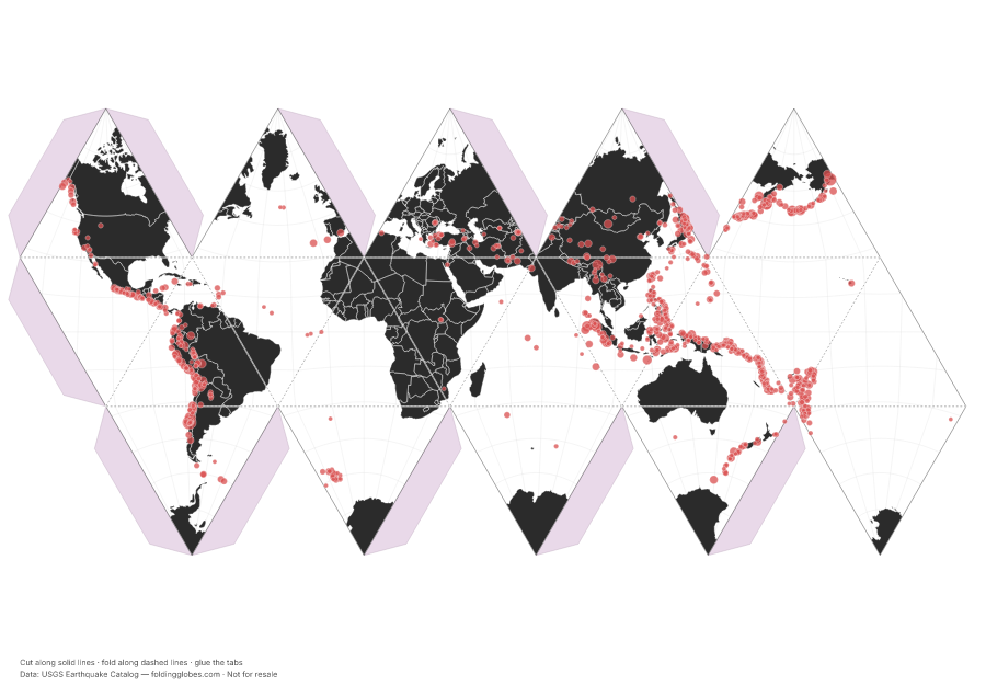
Every magnitude-7+ earthquake since 1950 — the Ring of Fire draws itself.
Drag to spin — this is what yours looks like folded.
About this globe
Every earthquake of magnitude 7 or greater recorded since 1950, from the USGS catalog. Nobody drew the plate boundaries on this globe — the earthquakes draw them for you.
Dot size scales with magnitude, and the scale is deceptive: each whole-number step releases about 32 times more energy. The Ring of Fire around the Pacific holds most of the planet's largest quakes.
How the data was captured
Recorded by the global network of seismometers — instruments that feel the planet shake from thousands of kilometers away. Comparing arrival times at many stations pins down each quake's location and magnitude.
Download free — pick your paper size
Print at 100% scale. Cut along solid lines, fold along dashed lines, glue the tabs. Your PDF can take up to a minute to prepare — hang tight after clicking.
In the US? Print the A4 file and choose “fit to page” — it scales cleanly onto Letter paper.
Sharing this globe?
Free for personal use, classrooms, and gifts — not for resale. If you post it on your site or share it online, please credit Folding Globes with a link. Copy-paste blurb:
"A Century of Great Earthquakes" folding paper globe — free from Folding Globes, https://foldingglobes.com/globes/earthquakes · Data: USGS Earthquake Catalog
Make it yours
Every paid shape also lets you pin your own places on the map.